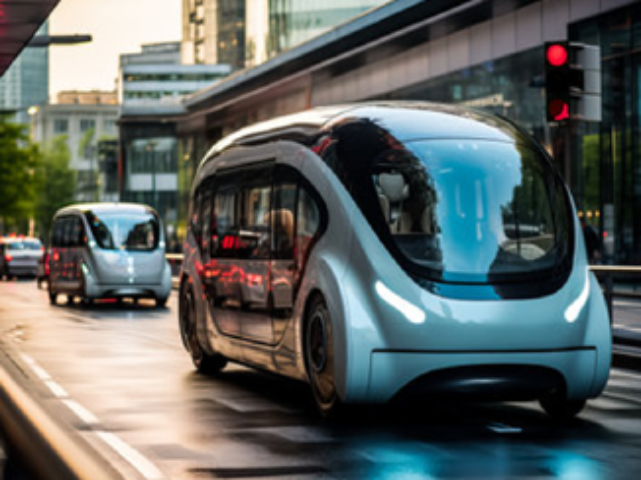
What is ADAS and Autonomous Vehicles ?
ADAS and Autonomous Vehicles - It is the process of labeling raw sensor data (images, video, LiDAR point clouds, and radar data) collected by vehicles with metadata tags to create ground truth datasets. This precise labeling is essential for training, validating, and improving the computer vision and machine learning models that enable advanced driver-assistance systems (ADAS) and fully autonomous driving capabilities.
The Data Challenge in Autonomous Driving
Autonomous systems require a massive, continuous stream of meticulously labeled data from various sensors – Lidar, radar, and multiple cameras. This data must accurately capture real-world complexity, including weather variations, unpredictable pedestrians, and rare “edge cases” that are critical for safety.
Our Expertise in Addressing Complex Data Needs:
- Sensor Fusion: Seamlessly annotating and aligning data from multiple sensors to create a unified 3D and 2D perception map.
- Edge Case Detection: Identifying and accurately labeling rare or unusual scenarios (e.g., unexpected debris, unreadable signs) that are vital for robust AI training.
- Accuracy and Scale: Providing human-in-the-loop validation and scalable workflows to handle petabytes of data while maintaining near-perfect precision.
Our High-Precision Data Annotation Services
We specialise in the diverse and demanding annotation types required for ADAS and AV development. Our expert annotators utilize advanced tools and robust quality assurance protocols to ensure supreme accuracy.
Key Annotation Services:
Why Partner with Qualitas Global?
Choosing a data partner is a critical strategic decision.
At Qualitas Global, we combine technical excellence with operational integrity to accelerate your project confidently.
- Dedicated Automotive Expertise: Our teams are specifically trained in the taxonomy, safety standards, and labeling protocols unique to the ADAS and autonomous vehicle industry.
- Scalability & Speed: We rapidly deploy secure, large-scale annotation teams tailored to your project volume, ensuring fast turnaround times without compromising quality.
- Security & Compliance: We operate under strict security measures to protect your sensitive proprietary data and ensure compliance with global data handling standards.
- Custom Tooling Integration: We adapt to your existing platform or utilize best-in-class annotation tools to seamlessly integrate with your engineering pipeline.
Ready to Drive Your Autonomous Future?
Talk to a Qualitas Global specialist today about how our high-quality data annotation services can help your ADAS and autonomous vehicle systems achieve the reliability and safety the world expects.
Object Detection
(2D/3D)
For annotation that helps on Object Detection, our team uses Bounding Box & Polygon annotations for accurate identification & classification of objects like Vehicles, Pedestrians & Traffic Lights. This helps in identifying & localizing various objects in the scene, allowing the autonomous vehicle's perception system to understand its surroundings.
Vehicle
Keypoint
Keypoint Annotation on vehicles involves labeling specific points like Headlights, Doors, Tail Lights, Wheels, etc. By annotating key points on vehicles, AI algorithms can precisely locate & track these specific points.
Drivable Region & Road Boundaries Annotation
For Drivable Region & Road Boundaries Annotation, our team uses Polyline & Polygon annotation to mark the Lanes, Drivable Region & Boundaries on the images. This annotated data serves various purposes, including training autonomous vehicles for lane detection, path planning & understanding road infrastructure & is very helpful for ADAS services.
License Plate Annotation
Labelling license plate regions in images or video frames & transcribing the text. It facilitates automatic license plate recognition systems, enabling accurate identification & extraction of plate information for vehicle tracking, law enforcement & traffic management purposes.
Vehicle Tracking On Video Annotation
Vehicle Tracking For Video Annotation involves annotating the vehicle’s positions & trajectories across frames, utilizing bounding boxes or key points. This technique facilitates the analysis of vehicle behaviour, traffic flow & interactions, enhancing understanding & enabling applications like autonomous driving & traffic management.
Full Scene Labelling
Full Scene Labelling is one of the most complex annotation services wherein our team annotates all the objects, entities & attributes present in the image. This service enables the vehicle to detect & track objects, recognize & interpret all the exterior & interior objects including traffic signs, road markings, sky vegetation, cars, poles, wires, etc.
Sensor Fusion Annotation
Sensor Fusion Annotation involves annotation of synchronized data from multiple sensors such as cameras, LiDAR & RADAR. It provides ground truth for developing perception systems by accurately labelling objects based on fused sensor data.
House Number Annotation
Using bounding box annotation techniques, our annotators labeled house numbers within images, focusing on the "House Number" class. This data helps autonomous vehicles in precise navigation and reaching destinations accurately.
Obstacle Detection
In Obstacle Detection projects, our team accurately marks vehicles on roads. This process involves delineating each vehicle's precise location & dimensions within images, aiding in traffic monitoring & road safety efforts.